21
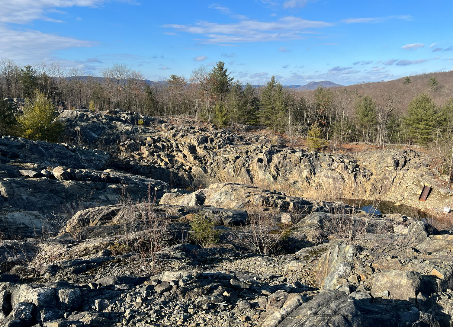
Once past this obstacle, you are now on the site of the DuPont property’s Area of Concern #1. Officially abbreviated within Environmental Protection Agency documentation as AOCs, there are over two hundred of these individually identified and profiled within the property’s borders, defining areas suspected of soil contamination. The sight before you should make clear why the numbering of AOCs starts here.
Effectively the epicenter of pollution that flows out of DuPont’s property, AOC #1, named “Old Cap Destruction Facility (Old Shooting Pond)” is a massive, manufactured crater in the earth, used to dispose of defective or excess explosives that were produced on-site. More akin to a quarry than a pond, the explosives fractured the bedrock upon detonation, allowing a list of pollutants, the most prominent of which is mercury fulminate, to seep into the groundwater. Sediments were also carried into town by the adjacent Acid Brook, which flows into the borough’s namesake, Pompton Lake. Its description in the AOC Summary Table reads as follows: “Used to detonate off-specification mercury fulminate caps. The detonation process resulted in a mixture of detonator fragments and pulverized rock that accumulated at the bottom of the pond and the splash zone surrounding the pond.”
Here, the scale of destruction is most palpable. Rusted shells are strewn about the folds in the rock, which mimic, or perhaps exhibit, the glacial striations that formed them, making it impossible to differentiate the built (or blasted) environment from the natural one.
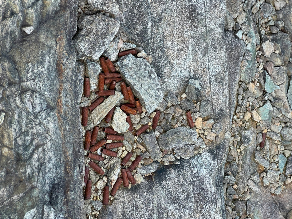
Industrial waste among chipped rocks at AOC #1