27
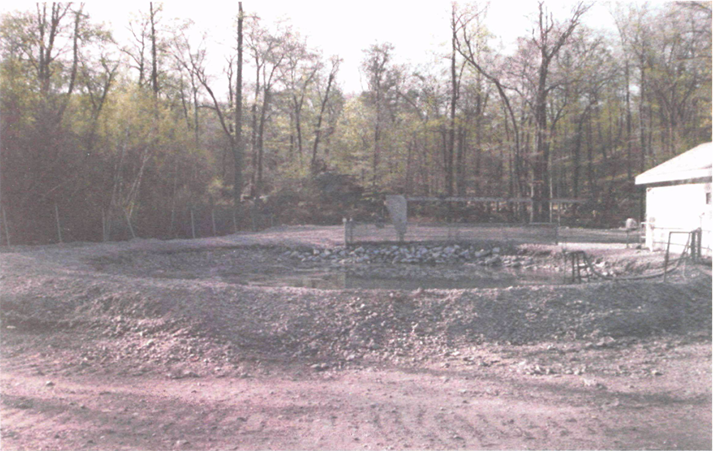
Continue your descent on this road. You’ll see what looks like a marshy area to your right. This is the filled-in site of AOC #4, “Sludge Pile and Burning Pit,” an “unlined pit 4-5 ft deep 30 ft diameter that received lead carbonate sludge from lead azide manufacturing… also burned boron/red lead powder waste, and waste cordline.” Beyond the growing reeds is another shooting pond at AOC #5, this one much smaller and less noticeable, with vegetation encroaching. You’ll see a small berm around it, reinforcing its shape, almost that of a perfect circle, its seeming containment contrasting the all-consuming nature of the shooting pond at AOC #1.
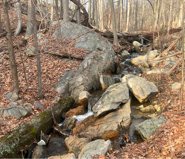
The gabions alongside the road soon turn to guard rails as you continue along, and the gravel road to pavement. The pavement looks relatively fresh, owing to its lack of use. The intactness of the infrastructure is striking as you climb further down into the Acid Brook Valley, making your way through a dense hilly forest on a wide road complete with bridges and culverts for the eponymous channel. After the first crossing, the stream curves left, with the road paralleling at a distance. The water tumbles down a small cascade, more scenic than any fall I can recall seeing in the State Forest, but far less pristine.
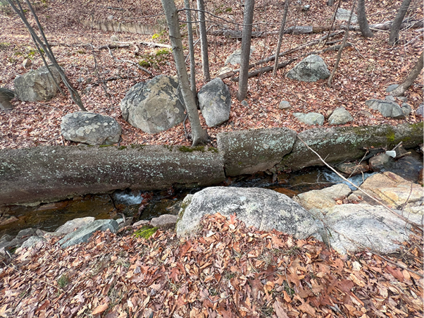
After its fall, the brook soon enters a narrow gap in a rock outcrop, worn smooth enough to plausibly be a hydrogeological formation, but linear enough in its direct cut to be uncanny. Not much further along, the Acid Brook becomes channelized and lined with riprap as it begins to near a cluster of Areas of Concern. The encasement is a concrete reminder that although beautiful and naturalistic in its upper reaches, the entirety of Acid Brook itself is listed as AOC #118.
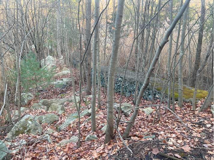
Above: Filled-in pit at AOC #4, photo by the author
Below: Shooting pond at AOC #5, photo from EPA report #EPA/902/8-87-002 by Malcolm S. Field, Plate 1